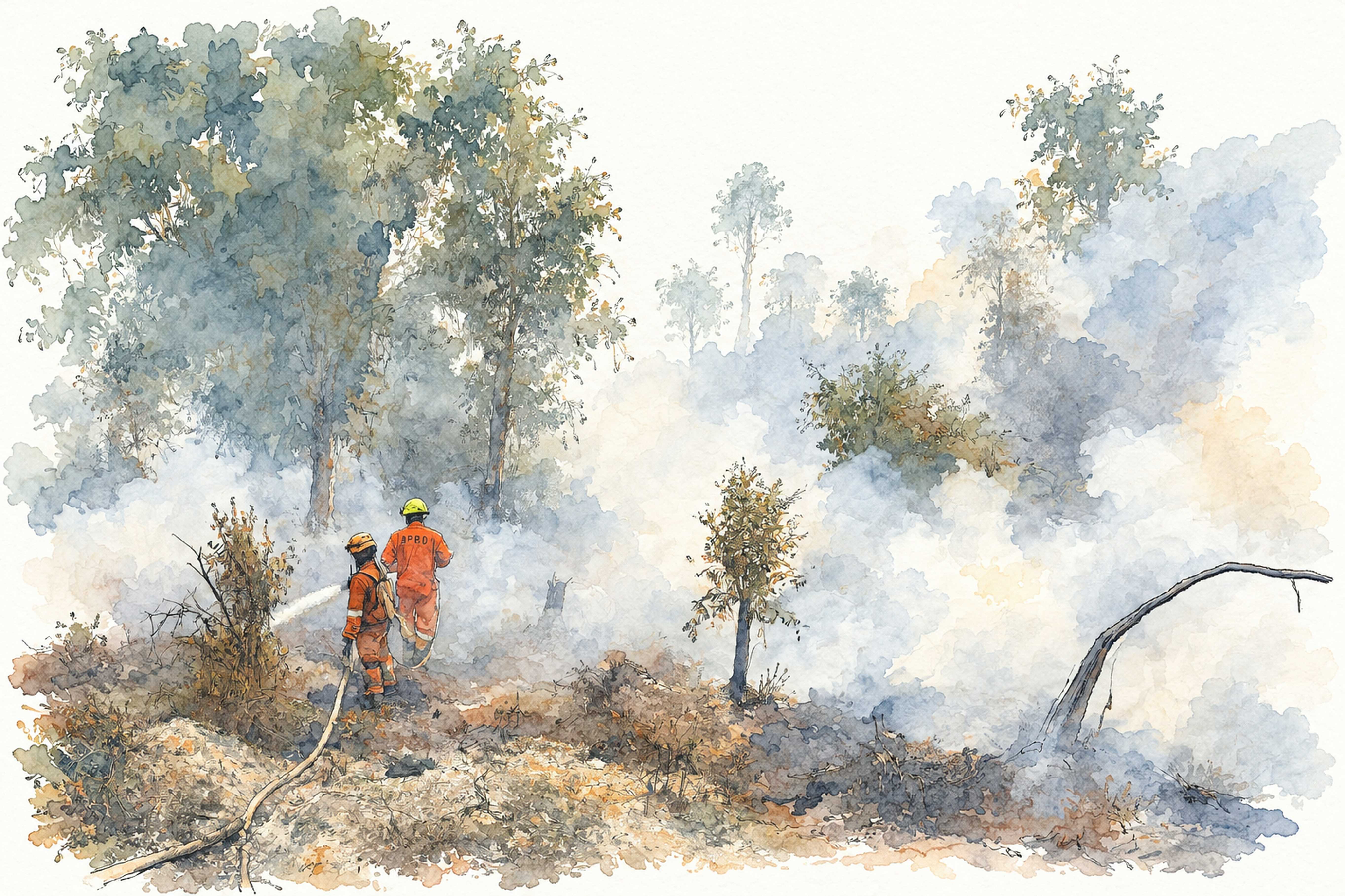
On Monday morning, the sun over Sumatra had not disappeared. It had simply become difficult to see. Across wide stretches of the island, daylight arrived through a gray-brown veil that erased distance and softened the outlines of roads, buildings and trees. The sky seemed less like weather than a ceiling lowered over the landscape. By 10 a.m., satellite imagery processed by Indonesia’s Meteorology, Climatology and Geophysics Agency, or BMKG, detected smoke from forest and land fires across North Sumatra, Riau, West Sumatra, Riau Islands, Bangka Belitung, Jambi, Bengkulu and South Sumatra. Aceh and Lampung were largely outside the main smoke-affected area, although fires were detected in both provinces. The map showed something larger than a collection of local fires: an atmospheric event spreading across a substantial part of an island.
The first place where such an event becomes impossible to ignore is often an airport. In Jambi, eight flights were delayed by 9 a.m. because visibility had fallen to 600 meters at 8 a.m., improving only to 800 meters by 9:30 a.m. In Palembang, 18 flights at Sultan Mahmud Badaruddin II International Airport were disrupted on Monday, including 11 departures and seven arrivals, after visibility fell below operational limits. The airport’s problem was brutally simple. An aircraft can be rerouted, a schedule can be rewritten and a passenger can be asked to wait, but none of those administrative solutions can make the atmosphere transparent.
This is one of the peculiarities of haze as a disaster. It does not necessarily destroy the things people associate with disaster. Roads remain in place. Buildings remain standing. Shops open. Traffic continues. The airport remains intact, but the runway becomes less usable. The city functions, but the medium through which people move through it becomes hazardous. A disaster can therefore be present without producing the physical wreckage that normally tells a population something has gone badly wrong.
Palembang offered a more severe measure. BMKG monitoring showed PM2.5 concentrations reaching 881 micrograms per cubic meter at Talang Betutu at 7 a.m. and 802.3 micrograms per cubic meter at Musi II at 3 a.m. BMKG classifies concentrations above 250.5 micrograms per cubic meter as hazardous. At those levels, the haze is no longer merely a reduction in visibility. The air itself has become the site of the emergency.
The numbers are difficult to translate into ordinary experience because weather has a familiar vocabulary and particulate pollution does not. People understand rain because rain lands on the skin. They understand wind because trees move. PM2.5 is different. These are particles 2.5 micrometers or smaller, invisible individually and carried through the same atmosphere that otherwise appears empty. Their danger is therefore easy to overlook until the concentration becomes extreme. The monitoring station sees the crisis before the human eye can fully describe it.
But even the most alarming number tells only part of the story. Air quality is not uniform across Sumatra, and neither is exposure. In North Sumatra, smoke was detected across Labuhanbatu, South Labuhanbatu, North Labuhanbatu, Padang Lawas, North Padang Lawas, Mandailing Natal, South Tapanuli, Asahan and Tanjungbalai. At Aek Godang Meteorological Station in North Padang Lawas, visibility fell to about 5 kilometers from 10 kilometers or more under unobstructed conditions. Yet air quality remained generally in the good-to-moderate range and daily activity continued without major disruption.
The difference is important because it prevents the word “haze” from becoming a single national condition. The same smoke event can mean a hazardous atmosphere in Palembang, a reduced horizon in North Sumatra and an ordinary-looking day elsewhere. The physical phenomenon is regional; the human experience is local.
That unevenness also complicates the question of where the crisis begins. North Sumatra, for example, was not necessarily the source of the smoke affecting its southern districts. The haze was believed to have been transported from areas of South Sumatra where fires remained active. Residents could therefore experience the consequences of a fire without living anywhere near its point of ignition. In early September, fires had also occurred in parts of North Labuhanbatu, although they were described as relatively limited and were extinguished. By October, local authorities reported that the region was entering the rainy season, while residents said the smell of smoke was not prominent.
Yet families were still noticing something more intimate than a satellite image. Children were increasingly vulnerable to respiratory symptoms, including coughing, runny noses, sore throats and fever. Such symptoms cannot automatically be attributed to haze in individual cases; respiratory infections have multiple causes. But they demonstrate why the geographical distance between a fire and its smoke does not translate into a distance between the fire and its victims.
The atmosphere has no provincial administration.
Government, however, does. A province has an environmental authority, a district has its own administration, a conservation area has a management structure, and a plantation concession has a defined legal boundary. Smoke moves through all of them without asking permission. By the time it becomes visible over a city, the original fire may already be somewhere else.
This is why the language of “forest and land fires” can conceal as much as it reveals. It correctly describes the immediate phenomenon, but it does not explain why particular landscapes burn more readily than others or why some fires persist long enough to become regional sources of pollution. It does not tell the public what happened to the land before the flame appeared.
The crucial distinction is between a fire and a landscape capable of sustaining one.
Peat makes that distinction particularly consequential. Intact peatlands are waterlogged ecosystems built from organic material accumulated over very long periods. Once their hydrology is disrupted and the peat dries, the same material can become combustible. Fire can move below the surface, smoldering through layers that are difficult to detect and even harder to extinguish. The flame visible from above may therefore be only the exposed portion of a much deeper process.
The smoke above Sumatra was the final stage of that process, not its beginning.
It was also a reminder that the geography of a fire is larger than its point of origin. The airport in Jambi, the monitoring station in North Padang Lawas and the PM2.5 sensors in Palembang were measuring different expressions of a connected atmospheric event. Their instruments did not know which district was responsible for the fire. They measured what had reached them.
The public did the same thing in a less precise way. People looked at the sky, smelled smoke, watched the road disappear into haze and decided whether to continue their routines. They were reading the consequences of a fire whose origins were mostly beyond their immediate view.
That is the first paradox of the haze: the closer it comes to ordinary life, the farther away its causes can seem.
The landscape that burns
The clearest way to understand the fire is to leave the airport and follow the landscape east.
In Jambi, the geography of the fires has been changing rapidly. An analysis by the Geographic Information System division of the Indonesian Conservation Community, or KKI Warsi, indicated that the area affected by fire in the province had expanded to about 36,800 hectares, an increase of more than 3,000 hectares in roughly a week. Earlier analysis by the organization had placed the burned area at about 33,180 hectares as of Sept. 25. The figures are based on spatial analysis rather than the same administrative reporting system used by government agencies, so they should not be treated as directly interchangeable. What matters is the direction of the change: the fire was expanding, and peatland in eastern Jambi had become increasingly important to the pattern.
Tanjung Jabung Timur emerged as the district with the largest affected area. The significance of that shift was not simply statistical. It meant that the fire was moving deeper into the eastern peatland landscape, including the Berbak-Sembilang ecosystem, where the distinction between a local agricultural fire and a conservation crisis becomes increasingly difficult to maintain.
The Berbak-Sembilang landscape stretches across Jambi and South Sumatra. Its ecological continuity is obvious to a fire even if its administrative structure is not. A fire that develops on the Sembilang side of South Sumatra can move northward into Berbak in Jambi. That is what KKI Warsi has been documenting. The fire was reported to have begun in parts of Sembilang, including traditional-use areas, before moving toward more strictly protected zones on the Berbak side. By early October, analysis indicated that thousands of hectares within TNBS had burned, threatening habitat for protected species including the Sumatran tiger (Panthera tigris sumatrae).
The movement is significant because protected status is a legal category, while fire is a physical process. A national park boundary can determine which agency has authority and what activities are permitted. It cannot stop a smoldering peat layer from advancing beneath the surface.
This is the essential problem with treating the fire as a series of administrative incidents. The landscape is one ecological system but several administrative territories. South Sumatra can record a fire. Jambi can inherit it. A national park can receive the flames after they have already developed elsewhere. The atmosphere can then carry the smoke into cities that have no connection to the land except through the air they share.
The peat itself makes the problem more difficult. Unlike a surface fire that announces its movement with visible flames, a peat fire can continue beneath the ground. The material that burns is not simply grass or fallen branches. Dried peat can provide a continuous underground fuel source, allowing combustion to persist after the visible fire front has disappeared. That is why suppression can require far more than extinguishing what can be seen.
It also explains why the condition of the landscape before the fire matters so much. When peat remains wet, it is much less susceptible to burning. When drainage lowers the water table and prolonged dry weather removes further moisture, the risk changes. The question is therefore not merely why somebody started a fire. It is also why the land was capable of carrying that fire so far.
Indonesia’s present crisis has revived that question. Reuters reported Monday that environmental groups estimate about 16 million of Indonesia’s roughly 24 million hectares of peatland have become more fire-prone because of degradation, while only a small proportion of peatland damaged by fires between 2015 and 2019 has been restored. The figures come from environmental groups and are not equivalent to a government inventory, but they point toward a problem that cannot be solved through emergency suppression alone.
The dry season then acts less like an isolated cause than an accelerator.
BMKG had warned that dry conditions, high temperatures and low humidity could increase the risk of forest and land fires during the period. Its forecast for late September and early October identified several areas of Sumatra for continued vigilance. Weather can determine how readily a landscape burns, but it does not explain why some landscapes are more vulnerable when the dry period arrives.
This distinction has consequences for public policy. If the crisis is understood primarily as an episode of bad weather, the logical response is to wait for rain, modify weather where possible and fight fires once they appear. If it is understood as the interaction of weather with degraded landscapes, then prevention begins much earlier, with water management, peat restoration, land-use control, early detection and enforcement.
The difference is between fighting the fire and reducing the reasons it can become a large fire.
South Sumatra illustrates the scale of the challenge. According to provincial disaster-management data cited in recent reporting, the province recorded 27,861 hotspots from January through September 2026, exceeding the number reported during the severe 2015 fire season. Hotspots are indicators detected by satellites and should not be equated one-for-one with individual fires or burned hectares. Nevertheless, the scale of the increase provides an indication of the intensity of the season.
The response has consequently become a contest over what counts as action.
South Sumatra Governor Herman Deru has said the provincial task force is operating both on the ground and from the air, with helicopters conducting water bombing and weather modification operations also being used. He has also said police have named 39 people as suspects and that authorities are investigating possible corporate involvement. If companies are proven responsible, he has said permits could be revoked within provincial authority or recommendations could be submitted to the central government.
These are measurable interventions. They produce aircraft sorties, water drops, investigations and official announcements. They are also politically visible. A helicopter hovering over a fire is easier to present as evidence of government action than a restored peat water table that prevents a fire from starting.
That difference matters because prevention is often invisible.
A successful fire-prevention program produces a peculiar kind of evidence: nothing happens. No smoke rises. No flight is delayed. No emergency briefing is called. No helicopter appears on television. A restored wetland does not provide the same spectacle as a water-bombing operation.
This does not make emergency operations unnecessary. It makes them an incomplete measure of whether the underlying problem is being reduced.
The distinction becomes particularly important in Berbak-Sembilang. A national park is supposed to represent a higher level of ecological protection, but protection becomes difficult to defend if the surrounding landscape remains vulnerable to fire. Conservation cannot be reduced to drawing a line around an ecosystem and assuming the line will hold.
Wildlife makes the limits of that approach visible. The Sumatran tiger does not understand whether it is moving through a traditional-use zone, a forest park or a national-park wilderness zone. Its habitat is a continuous landscape. Fire can fragment that landscape regardless of the legal status attached to each section.
The same is true of water.
Peatland hydrology connects areas that administrative maps separate. Water moves through the landscape. Drainage in one place can affect the moisture condition of another. A dry peat surface does not become safe simply because a district boundary begins a few kilometers away.
The fire thus exposes an administrative paradox. Government has become increasingly capable of measuring the crisis, but measurement does not automatically produce coordination. Satellite systems can identify hotspots. Spatial analysis can estimate burned areas. Air-quality stations can record PM2.5. Airports can report visibility. Health agencies can count respiratory cases. Yet each instrument observes a different piece of the same event.
The result can be a highly quantified crisis that remains structurally difficult to govern.
There are numbers everywhere: hotspots, hectares, micrograms, flights, suspects, helicopters, sorties and health cases. The abundance of numbers can create the impression that the problem is under control because it is being measured. But measurement is not prevention.
The fire in Berbak-Sembilang makes that distinction unusually clear. Its movement across provincial and conservation boundaries demonstrates that the relevant unit for managing peatland fire is not necessarily the district, province or institution. It is the landscape.
The smoke follows the same logic.
The normalization of disaster
There is a moment in every recurring haze crisis when an emergency begins to resemble a routine.
People check the air-quality index before leaving home. Parents wonder whether children should spend time outdoors. Drivers slow down because the road has disappeared into a gray curtain. Passengers wait for an announcement at the airport. Masks return to faces. Schools and workplaces make temporary adjustments. Then, as visibility improves, the routines become less noticeable.
This is how a disaster can become ordinary without becoming less dangerous.
The most revealing feature of haze may therefore not be the day on which the air becomes hazardous, but what happens afterward. A society that experiences the same environmental disruption repeatedly develops ways of accommodating it. Adaptation is a useful human response, but in the context of public policy it can produce an unintended consequence: the burden of managing environmental failure gradually shifts from institutions to individuals.
The family buys masks. The passenger waits for the flight. The driver slows down. The parent keeps a child indoors. The resident checks the monitoring application. Each adjustment reduces the immediate disruption. Collectively, however, they can make an abnormal environment easier to tolerate.
That is the political danger of normalization.
Palembang provides a sharp example. On Monday, PM2.5 readings at Talang Betutu and Musi II reached hazardous levels, while 18 flights were delayed because visibility fell below operational limits. The city nevertheless continued functioning. People went to work, traveled by road and carried on with ordinary tasks. The infrastructure of everyday life did not collapse; it simply operated under increasingly degraded conditions.
The city can therefore absorb a surprising amount of environmental damage without appearing to be in a state of emergency.
Health is where that absorption becomes harder to hide.
South Sumatra’s health authorities recorded tens of thousands of cases of acute respiratory infection in September, with children among those affected. Such figures must be interpreted carefully because respiratory infections have many causes and surveillance data alone cannot attribute every case to smoke exposure. But the scale of illness during a severe haze episode shows why health cannot be treated as a secondary consequence of firefighting. Once particulate pollution reaches hazardous concentrations, the public-health question is no longer peripheral to the fire. It is one of its principal consequences.
Children are particularly revealing because they have the least control over exposure. They cannot decide whether the school air is safe. They cannot determine whether their neighborhood is downwind of a fire. They cannot change the land management practices that made a peatland combustible. The distance between a burning landscape and a child’s lungs may be hundreds of kilometers, but atmospheric transport collapses that distance.
That is also why the distinction between source and recipient becomes morally uncomfortable. The residents of Palembang did not need to set a fire to suffer its consequences. A child in North Sumatra did not need to live on peatland to breathe smoke transported from another province. An airline passenger did not need to have any relationship to the burning landscape to lose several hours in an airport.
The costs travel more easily than responsibility.
The student protests outside the South Sumatra governor’s office on Monday made that problem explicit. Hundreds of students demanded a more serious response and gave the provincial government a five-by-24-hour deadline to demonstrate action they described as serious, measurable, transparent and accountable. Their protest was not simply about smoke. It was about whether government activity could be translated into an accountable public response.
The governor’s answer emphasized the machinery of response: the task force, helicopters, water bombing, weather modification and law enforcement. Those measures demonstrate that the state is not absent. The more difficult question is whether the state is addressing the conditions that make repeated emergency intervention necessary.
There is a seductive simplicity in counting response. A government can report how many helicopters are operating, how much water has been dropped, how many weather-modification missions have been conducted and how many suspects have been named. Each number represents something tangible.
But the most important number may be the one that does not appear in an emergency briefing: how much less vulnerable is the landscape than it was before the crisis?
That question is harder because it requires time.
A helicopter can be deployed today. Peat restoration may take years. A suspect can be named this week. Institutional accountability may take months or longer. A cloud-seeding operation can be counted immediately. Preventing peat from drying out requires continuous management. Emergency response has a beginning and an end. Landscape restoration does not fit so neatly into a news cycle.
This asymmetry helps explain why fire prevention repeatedly struggles to compete with firefighting for public attention. Firefighting is visible because failure is already happening. Prevention is invisible because success means nothing happens.
The consequence is a policy system that can become highly efficient at responding to symptoms while remaining less effective at eliminating the conditions that produce them.
That does not mean every fire is preventable or every government response is inadequate. Nor does it mean that every hotspot should be interpreted as evidence of administrative failure. Fire has multiple causes, including weather, human activity and land conditions, and the evidence available for individual incidents varies. But the recurrence of large-scale peatland fires raises a narrower and more defensible question: whether the prevention architecture is reducing the vulnerability of the landscapes known to be at high risk.
The answer cannot be found in one day’s hotspot count.
On Oct. 5, the Forestry Ministry reported 527 high-confidence hotspots nationwide through the previous evening, a decline of 139 from the day before. That decline could be encouraging in operational terms. Yet environmental groups warned that peatland fires can continue smoldering underground and that reduced hotspot counts do not necessarily mean the underlying risk has disappeared.
This is the problem with declaring victory too early. Satellite indicators measure what the satellite can detect. A peat fire can exist in ways that are less visible from above. A fire can also stop burning today and leave behind a landscape that is more vulnerable tomorrow.
The crisis therefore has two clocks.
The first is the emergency clock. It moves in hours. Visibility falls. Flights are delayed. PM2.5 rises. Fire crews respond. Helicopters fly. Officials issue statements.
The second is the ecological clock. It moves in years. Peat dries. Forests degrade. Water tables change. Restoration succeeds or fails. Land use is altered. Vulnerability accumulates.
Government is generally better organized around the first clock because emergencies create clear deadlines. The second clock is harder to govern because its failures may become visible only after years of accumulation.
That is where the haze becomes more than an environmental story.
It becomes a test of whether public institutions can act on causes that are less visible than consequences.
The answer cannot simply be more firefighting. Firefighting is indispensable once flames appear, but it is the final stage of a much longer process. Nor can weather modification be treated as a substitute for landscape management. Rain can interrupt a fire, but it cannot by itself restore a damaged peat ecosystem. Law enforcement is essential where wrongdoing is established, but prosecution after ignition cannot repair every ecological condition that allowed a fire to spread.
The central policy question is therefore not how quickly the government can extinguish a fire. It is how much effort is being spent making the next fire less capable of becoming a regional crisis.
That requires treating peatland as infrastructure rather than empty space: a hydrological system that stores water, carbon and biodiversity, and whose condition affects communities far beyond its boundaries. It requires treating air quality as public-health infrastructure rather than merely a weather report. It requires treating conservation boundaries as part of a connected landscape rather than as isolated administrative units. And it requires accountability that extends beyond identifying who started a fire to examining whether the land-management system made the fire unusually difficult to contain.
The smoke above Sumatra makes all of these connections visible at once.
A flight delayed in Jambi appears to be an aviation problem. A hazardous PM2.5 reading in Palembang appears to be an air-quality problem. A child with respiratory symptoms appears to be a health problem. A burning national park appears to be a conservation problem. A suspect in a fire investigation appears to be a law-enforcement problem.
They are not separate problems.
They are different consequences of the same landscape under stress.
That is why the question “Where the Smoke Begins” has no single geographic answer. It begins where peat dries. It begins where vegetation becomes combustible. It begins with ignition. It begins in land-use decisions and in failures of prevention. It begins wherever a landscape’s vulnerability becomes greater than the institutions responsible for managing it.
By the time the smoke reaches the city, the important decisions have already been made.
The airport sees the final link. The air-quality monitor records it. The hospital treats some of its consequences. The satellite photographs its spread. The government dispatches aircraft to fight it.
But beneath all of that is the landscape itself.
That is where the smoke begins.